There are many places in the greater Parlin area that are worth a visit. Check out all of the information below and let us know if you would like more details on any of the below options.
Nearby Activities & Attractions
Parlin Pond Township - Maine: An Encyclopedia
Parlin Pond Rest Area & Boat Launch
Piel Stream
Parlin Falls
Heald Stream Falls
Moxie Falls
Grand Falls
Cold Stream Falls
The Falls (Jim Mac Falls)
Owls Head
Parlin Mountain
Spencer POW Camp
H.P. McKenney Log Sluice
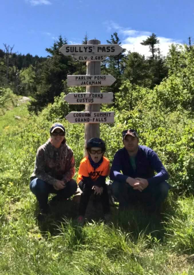
Coburn Mountain
Williams Mountain
Sally Mountain
Boundary Bald Mountain
Mount Kineo
Rockwood Rest Area & Boat Launch
The Forks Rest Area
Attean Rest Area
Jackman Moose River Historical Society & Museum
Various Historic Sites & Rest Areas along Route 201 & the Kennebec River.
Town of Jackman:
Piel Stream:
Stay right on site and cool off or go fishing in Piel Stream with easy access in front of Moxie Cabin. The cool shallow water is perfect for kids. Or a very small hike upstream takes you to the "swimming hole" which is sandy and usually 6+ feet deep.
Parlin Pond Rest Area & Boat Launch
Piel Stream
Parlin Falls
Heald Stream Falls
Moxie Falls
Grand Falls
Cold Stream Falls
The Falls (Jim Mac Falls)
Owls Head
Parlin Mountain
Spencer POW Camp
H.P. McKenney Log Sluice
Coburn Mountain
Williams Mountain
Sally Mountain
Boundary Bald Mountain
Mount Kineo
Rockwood Rest Area & Boat Launch
The Forks Rest Area
Attean Rest Area
Jackman Moose River Historical Society & Museum
Various Historic Sites & Rest Areas along Route 201 & the Kennebec River.
- This is the route Benedict Arnold took in September 1775 in order to invade Quebec, arriving in Quebec City in November.
- Link: Benedict Arnold's Expedition to Quebec
Town of Jackman:
- Town Park with Playground, Info Center and foot access to Big Wood Pond.
- Various Stores for groceries, hardware, snacks and gas.
- Various dining options.
- Boat Ramp access to Big Wood Pond.
- Boat Ramp access to Attean Pond.
- Jackman Trading Post
- Jackman Power Sports
- Jackman Library w/Free WiFi.
Piel Stream:
Stay right on site and cool off or go fishing in Piel Stream with easy access in front of Moxie Cabin. The cool shallow water is perfect for kids. Or a very small hike upstream takes you to the "swimming hole" which is sandy and usually 6+ feet deep.
White Water Rafting & Tubing
There are many great companies in the area for whitewater rafting on either the Kennebec or Dead Rivers. For a less extreme adventure, some offer self-guided tubing trips down the Kennebec. Contact us about nearby companies.
Visit Maine - Whitewater Rafting
Visit Maine - Whitewater Rafting
Hikes
Moxie Falls – Easy Walk – 1.0 Miles
In our opinion, the "best bang for your buck" due to the short ride south, easy walk, and impressive views and swimming holes. This 90-foot cascade, which is fed by Moxie Stream, is said to be the tallest “known" continuous waterfall in all of Maine. It’s a very popular site among visitors to the area too. After plummeting over stepped rapids above, the waters of Moxie Stream plunge 90-feet through a narrow gorge. From here, Moxie Stream flows right into the Kennebec River. The word “Moxie" is thought to have come from an old Abenaki Indian word meaning “dark water.” The falls were used as part of the yearly Kennebec River logging drives prior to their end in 1976. Huge logs were dropped over the large waterfall and into the Kennebec. In 1994 a portion of the Disney movie “Iron Will" was actually filmed at the falls.
The access trail into Moxie Falls is very well maintained. The falls can be reached easily in 20-30 minutes. There are stairs located around all the steep areas within the gorge, and observations decks have been built as well along the rim of the gorge close to the falls. There are a few different swimming holes located a points just above the falls. For the more adventurous, it is possible to hike down and swim or fish in the water below the falls.
DIRECTIONS: Follow Route 201 south to the town of The Forks. After crossing The Kennebec River, turn left onto Lake Moxie Road and follow it for approximately 1 mile. Look for the signs for Moxie Falls and its parking area on the left. Follow the signs to the trail head.
Cold Stream Falls – Easy Walk – 1.0 Miles
Probably the “next best bang for your buck” this waterfall is right up there with Moxie Falls, though not quite as big. It’s a short ride down Rt. 201 to Capital Road then a short hike to the falls. Cold Stream Falls is a 20’ waterfall that is fed by Cold Stream and definitely lives up to its name. This water will cool you off! There is a nice large swimming hole at the base of the falls with two levels of rock ledge to jump from for the more adventurous. The hike itself is mostly flat and well marked with blue markers. There is a sign at the trailhead which is located along ITS 87 and is an easy drive to get to.
DIRECTIONS: Follow Route 201 south about 6 miles to Capital Road on the left. Cross over a bridge at 0.9 miles then soon after turn left onto Mountain Brook Rd. The road splits as soon as you turn onto it but you can take either path which soon becomes Snowmobile ITS 87. The road has a few bumps and rocks but passable by most all vehicles. Travel about 2 miles and the trailhead will be on your left, along a corner of ITS 87 with an open grassy parking area.
Williams Mountain - Moderate - 1.5 Miles
Nearby Williams Mtn. straddles the town lines of Misery Township and Parlin Pond Township. A steel fire tower, erected in 1914, still stands on the Williams summit, as does the old fire warden's cabin, which is in surprisingly good condition. A 1.5-mile blue blazed trail, constructed by the Maine Bureau of Parks and Lands in 2017, offers a gradual climb over the mountain's northeast ridgeline.
DIRECTIONS: Take Rt. 201 north to Parlin Mountain Road. Cross the bridge over Parlin Stream and bear left at the fork just after the bridge. After a few miles turn left onto Smith Pond Road and proceed a few more miles past Smith Pond. Trailhead will be on the right about a half mile past Smith Pond.
Number Five Mountain - Moderate - 3 Miles
Number Five Mountain is in the heart of the Leuthold Forest Preserve, just southwest of the Parlin area. The 16,934-acre chunk of forestland is owned by The Nature Conservancy and abuts a 50,000-acre swath of other public and private conservation lands. The 1933 fire tower still stands on the open summit ledges, reached via a 3-mile hike on the old fire warden's trail. The 360-degree vista is extraordinary. The trailhead is a 17-mile drive on the Spencer Road from Route 201 at Parlin Pond. The Spencer POW Camp Memorial is a must-see on the drive in.
Houston Brook Falls – Easy – 0.5 Miles
Houston Brook Falls is an amazing 40 foot cascading waterfall located just outside the town of Bingham. The falls are wild and rugged, with folded jagged outcrops of rock. Access to the falls is very easy too; through a well-maintained trail and a 10-minute walk from the road. There are also a few swimming spots; the best being the shallow rectangular channel right below the falls. The mist of the falls often makes the surrounding rocks wet a slippery so use caution if you plan to swim. Just downstream, this brook enters Wyman Lake; which is visible from the waterfall. The entire area is very scenic; with nothing to block many scenic local views.
DIRECTIONS: Go south on Route 201 into the town of Bingham. Turn right onto Route 16 (West) and cross the Kennebec River. Immediately after crossing the bridge, turn right onto Pleasant Ridge Road. Follow it past Wyman Dam along the lake for approximately 3.5 miles to the transfer station on the right. Park to the left of the fencing after you see the Houston Falls sign on your left. Follow the trail to the stream – a 5-10 minute walk.
Austin Gorge – Moderate – 0.25 Miles
Austin Stream runs through Bingham as a quiet trickle, but just a few miles upstream the water cascades over a series of waterfalls and slides hidden a short distance from a logging road. The drops here are very steep; dropping vertically 88 feet in a short 0.25 mile long section. There are five major drops that are visible; including a 10-foot waterfall.
DIRECTIONS: Follow Route 201 south to the town of Bingham and then turn left onto Route 16 East. Follow Route 16 for less than a mile and look for the “Dead Water Road" on your left (a dirt road). Follow Dead Water Road for 5.5 miles until the stream becomes visible on your left. The gorge is located just downstream from here. About 200 yards before the stream is visible on Dead Water Road there is a “hidden” trail head on the left (also suitable for 4×4 vehicles) that leads to the rim of the gorge; right above the second drop.
Caution: Logging trucks have the right of way on this dirt road. It’s owned by private lumber companies who must allow public access, but travelers still must yield to ALL logging traffic.
Grand Falls – Driving and Snowmobile Access – Easy Walk – 0.5 Miles
Grand Falls is an amazing waterfall unknown to many. The falls are just upstream from the rafting put-in for all whitewater trips on the Dead River – but you can’t see anything from your raft by looking upstream. The Grand Falls just happen to be “hiding" around a corner out of view!
Just upstream of the falls is one of the huts that make up the Maine Huts & Trails System. The “Grand Falls Hut", and others like it, are one of four currently in-place throughout the western Maine Mountains. This system of trails and huts is growing constantly. So, for more information on the Maine Hut and Trail system, please visit their website at; http://www.mainehuts.org/.
Grand Falls is also right along Maine’s ITS 89 snowmobile trail – so it’s now as popular a destination in the winter as in the summer. In the summer, you can also drive to the falls and see them with minimal walking.
DIRECTIONS: Go south on Route 201 11.4 miles and turn right onto The Lower Enchanted Road; a dirt logging road. Follow the Lower Enchanted Road to mile 4.7 where the road splits. Stay to the left-split on The Lower Enchanted Road. Continue straight past through intersections and bearing to the left in places wherever the road splits. At approximately mile 14 there is a large clearing and a small kiosk building. Pass the kiosk for a short distance and you will reach The Dead River. At the bottom of the hill you can park your car, and walk across the metal bridge over a stream that empties into The Dead River. Follow the obvious trail along the banks of The Dead River for only a few hundred yards to an overlook of Grand Falls.
CAUTION: Logging trucks have the right of way on these dirt roads. They are owned by private lumber companies who must allow public access, but travelers still must yield to ALL logging traffic.
Pierce Pond Stream (Falls & Gorge) – Moderate – 3 Miles
This spectacular “hidden jewel" is on the Appalachian Trail. and even as this scenic location provides great hiking, wildlife watching, and many waterfalls, it also draws top kayakers from around the world who are challenged by this classic and steep whitewater run. As for the gorge, it actually contains several 10, 20, and even 30 foot waterfalls along the 2.5 mile long trail. The river itself flows from Pierce Pond just 0.5 mile upstream from the road. This is where the Appalachian Trail meets up with the stream at a shelter on the southwest corner or Pierce Pond. Hikers traveling the Appalachian Trail pass through this area on their 2,200 mile journey to Mt. Katahdin in Baxter State Park.
Just upstream of the small pull-off/parking area is a small waterfall that’s visible from the road. Follow the trail downstream (you’ll be on The Appalachian Trail). The trail is marked by white blazes on the trees (as is the entire Appalachian Trail). Continue following the river, but use the trail with the “blue-blazes". You will have several observation points above the gorge as you walk. The river continues on to the Kennebec River; just below the last set of waterfalls that are visible. This is where the AT crosses the Kennebec and hikers must gain assistance in crossing the river. A canoe ferry is offered to get hikers across the river. This location is the only place on the entire Appalachian Trail where hikers must have assistance in their journey.
DIRECTIONS: Follow Route 201 south into the town of Bingham. Turn right onto Route 16 (west) and cross the bridge over The Kennebec River. Immediately after crossing the river turn right onto Pleasant Ridge Road. Follow this road past Wyman Dam and along the lake for about 4 miles until the road splits. Turn right towards Pierce Pond on Carry Pond Road. Follow this road, as it turns to a gravel road, for approximately 8 miles. Look for Carrying Place signs on right and pull off. Continue past the “Carrying Place Falls" area along the gravel road for another 7 miles (following the well traveled road bearing right). As the road crosses a bridge and a good-sized stream, the falls upstream can be seen and there is a pull-off just past the bridge on the right. There is also a sign for the Appalachian Trail and white blazes on the trees along the trail.
CAUTION: Logging trucks have the right of way on these dirt roads. They are owned by private lumber companies who allow public access but travelers must yield to ALL logging traffic.
Carrying Place Stream – Easy – 0.25 Miles
Spectacular waterfalls and slides highlight this scenic area. The 30-foot high cascading waterfalls and rapids are a result of carved bedrock filled-in by many large boulders. The stream itself drains East Carry Pond into The Kennebec River (called Wyman Lake above the dam).
This scenic location also has a special Colonial American historical importance. It was here that Benedict Arnold, along with his 1,000 men, camped and portaged their bateaux, cannons, and supplies, across the wilderness to the Dead River; heading north to Canada. This was part of a 1775 military campaign intended to capture Quebec and enlist its citizens into the war with Great Britain.
DIRECTIONS: Follow Route 201 south and turn right onto Route 16 west, crossing the bridge over The Kennebec River. Immediately after crossing the river turn right onto Pleasant Ridge Road. Follow this road past Wyman Dam and travel along the lake for about 4 miles until the road splits. Here you’ll turn right on Carry Pond Road (towards Pierce Pond). Follow this road as it turns to a gravel road for approximately 8 miles. Look for “Carrying Place" signs on right and pull off. This is Carrying Place Stream but the waterfalls are downstream. Hike down a small trail to the falls.
CAUTION: Logging trucks have the right of way on these dirt roads. They are owned by private lumber companies who allow public access but travelers must yield to ALL logging traffic.
